
Belém
Capital of Pará and gateway to the Amazon River.

Ridiculopathy · CC0
Belém, often called Belém of Pará, is the capital and largest city of the state of Pará in the North of Brazil. The city is known as the Metropolis of the Brazilian Amazon region and the City of Mango Trees due to the vast number of mango trees found there.
- Country
- Brazil
- State
- Pará
- Known for
- Gateway to the Amazon River, Círio de Nazaré procession
- Climate
- Tropical rainforest (Köppen: Af)
Lore & Background
The colony formed around the fort was named Feliz Lusitânia, which later became Nossa Senhora de Belém do Grão Pará. The early colonial economy of Belém and Pará was initially based on forest products known as drogas do sertão, and later on rubber, rather than a linear progression from sugar to cattle ranching to rice and cotton.
Reader's Guide
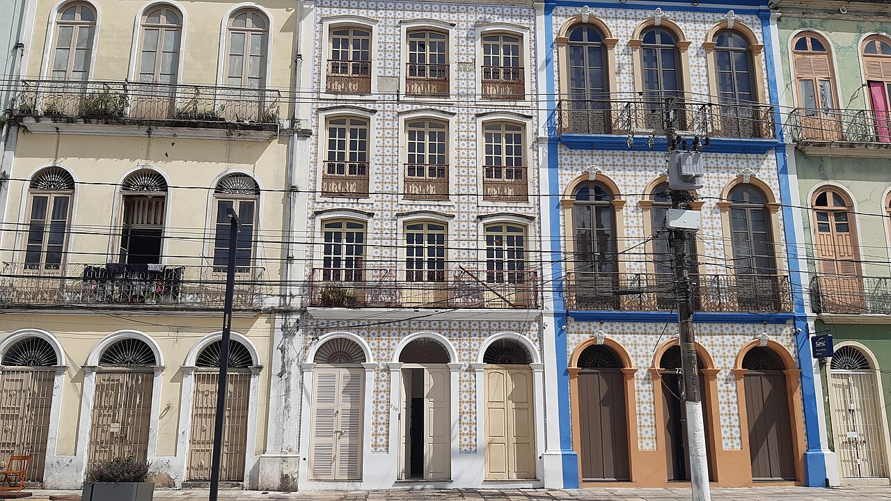
Belém holds significance as the first European colony on the Amazon and a historic hub for trade, particularly in sugar, rubber, and later metals, nuts, and hardwoods. Its colonial portion retains tree-filled squares, churches, and traditional blue tiles, while the newer part has modern skyscrapers. The city is home to the Federal University of Pará and the State University of Pará. Belém is served by Belém International Airport, connecting to Brazil, South America, North America, and Europe. The Círio de Nazaré, held on the second Sunday in October, is the largest religious event in Brazil. The city's economy relies on exports such as aluminium, iron ore, Brazil nuts, and jute, with electricity provided by the Tucuruí Dam. The population is predominantly Pardo (multiracial), with European, Amerindian, and African ancestral components.
Did You Know?
- Belém lies approximately 100 km upriver from the Atlantic Ocean on the Pará River.
- The city is named after Santa Maria de Belém in Lisbon.
- Belém was originally called Feliz Lusitânia before being renamed Nossa Senhora de Belém do Grão Pará.
- The Círio de Nazaré procession is the largest religious event in Brazil, drawing over 2 million participants.
Founding & Colonial Origins
The following January, he anchored in what is now Guajará Bay—formed where the Pará and Guamá Rivers meet—and, mistaking it for the main channel, pushed thirty leagues upstream to erect a straw-covered wooden fort he named Presépio, a word meaning Nativity Scene. That structure, later known as Forte do Castelo, anchored a settlement called Feliz Lusitânia, or Fortunate Lusitania, regarded as the embryonic core of modern Belém. Though the fort failed to halt Dutch and French commerce, it did prevent their colonization of the area. The colony was subsequently renamed Nossa Senhora de Belém do Grão-Pará and Santa Maria de Belém.
Economic Evolution & the Rubber Boom
Belém's economic identity has shifted dramatically over four centuries. Sugar cultivation dominated the region's trade until the late seventeenth century, after which cattle ranching took the lead. In the eighteenth century, rice, cotton, and coffee became profitable crops, but the settlement of southern Brazil—where those same products could be grown more efficiently—depressed Belém's fortunes. The city's greatest economic leap came with the Amazon rubber industry, which turned Belém into the principal exporting hub for the entire Amazon basin. Even the rise of the upriver Port of Manaus only partially eroded its position. Today, the city remains the twelfth most populous in Brazil and the sixteenth by economic relevance, anchoring the region's trade through its busy port, airport, and coach station.
Geography, Climate & Natural Setting
Belém sits roughly one hundred kilometers upriver from the Atlantic, on the Pará River, which feeds into the greater Amazon system. The city is separated from the larger portion of the Amazon delta by Ilha de Marajó, one of the world's great river islands. Its climate is a true equatorial one—Köppen classification Af—governed more by the Intertropical Convergence Zone than by maritime trade winds, with no cyclones and no month that falls below sixty millimeters of average rainfall. Temperatures hover near twenty-six and a half degrees Celsius year-round. A wetter stretch runs from December through May, while the remaining six months are comparatively drier, though never truly dry. The natural vegetation surrounding the city is Amazonian tropical rainforest, part of the largest and most species-rich tract of tropical forest on Earth, home to more than a third of all known species worldwide. The municipality also encompasses the islands of Mosqueiro, with its fourteen freshwater beaches that draw summer crowds, and Caratateua, as well as Tatuoca, site of one of only seven geophysical monitoring stations on the planet and the sole one in Latin America.
Naming, Identity & Modern Belém
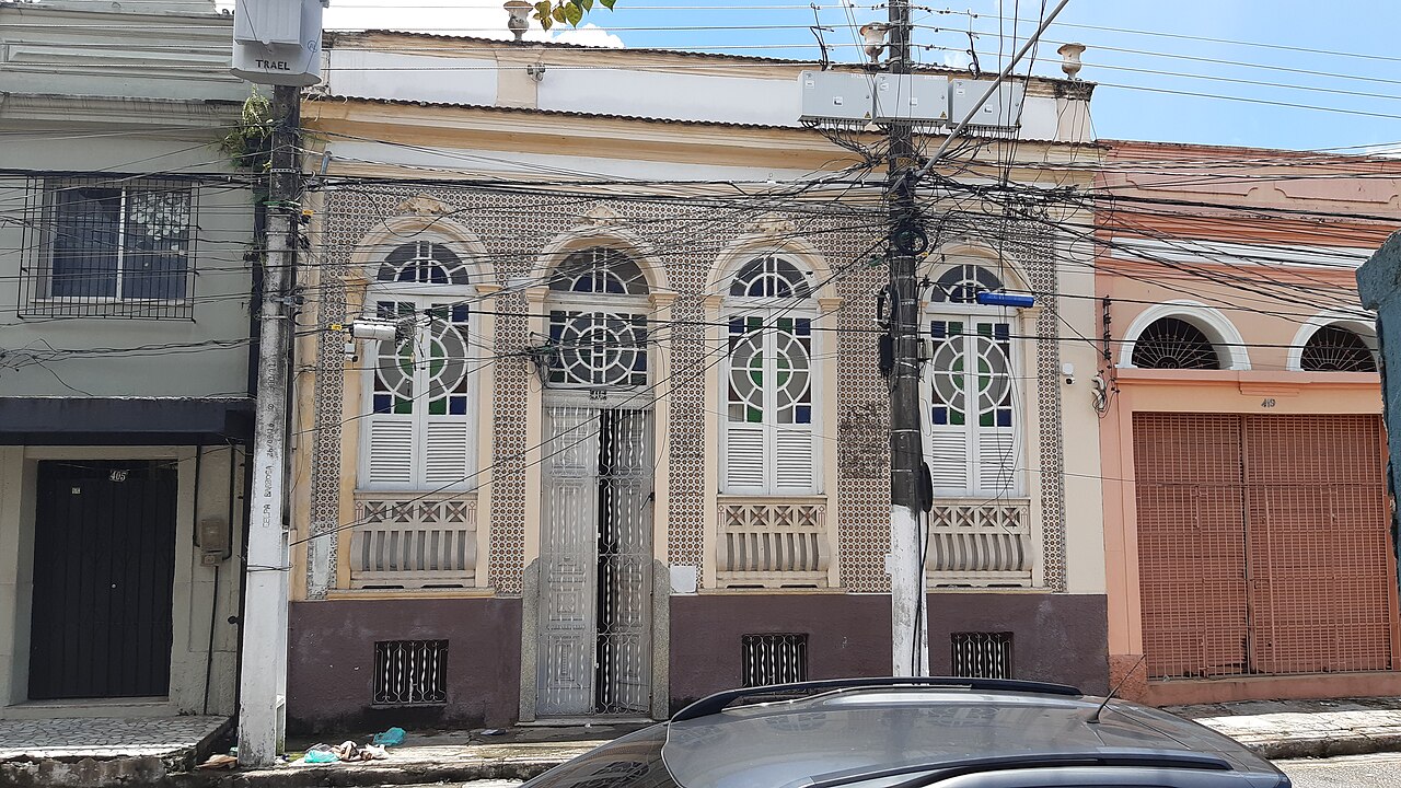
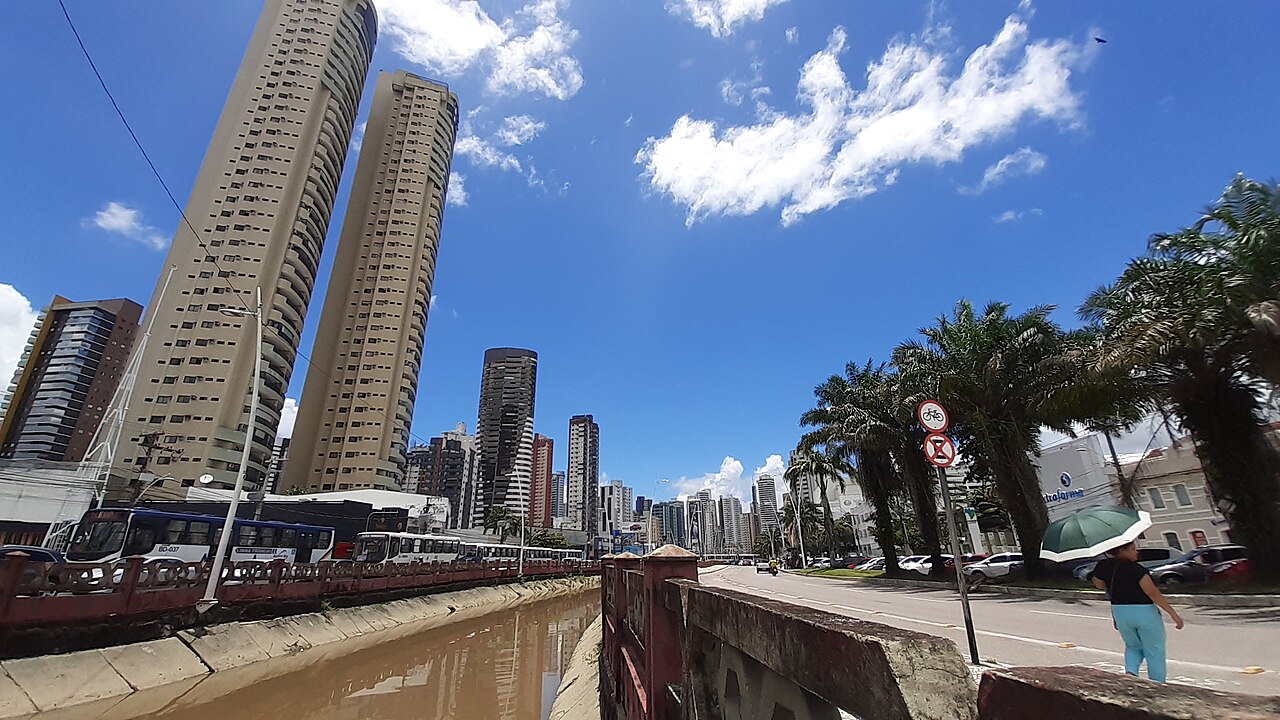
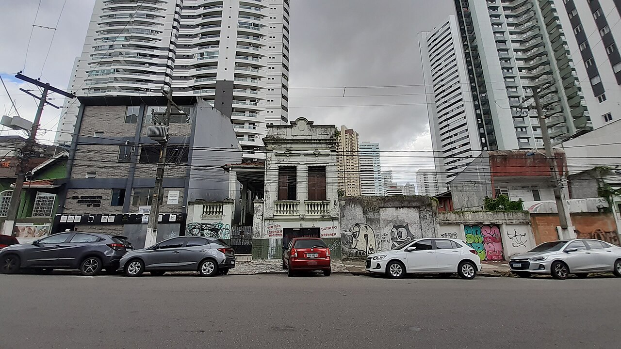
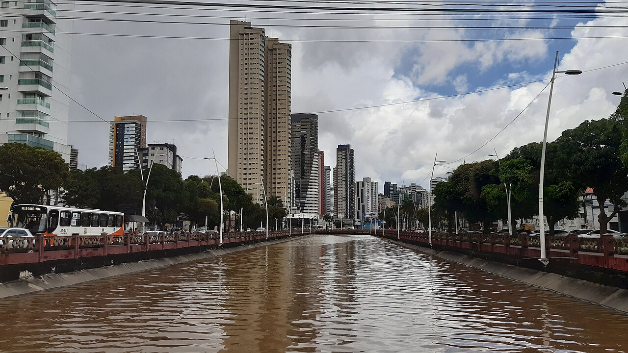
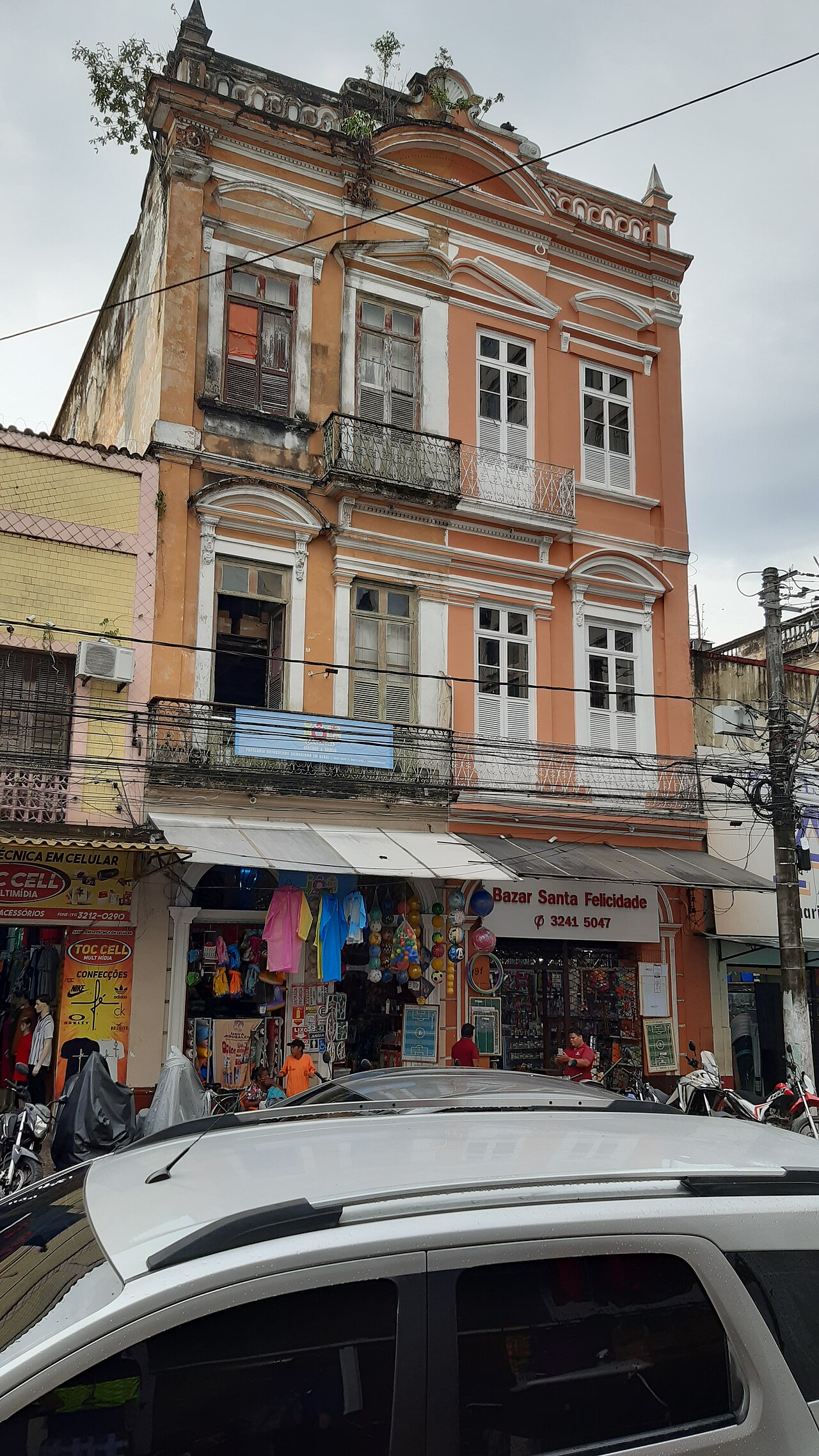
The name Belém is the Portuguese rendering of Bethlehem, itself derived from the Hebrew bēṯ lɛ́ḥɛm, meaning house of bread. The city's original full title—Santa Maria de Belém do Grão-Pará, or Our Lady of Bethlehem of Great Pará—eventually shortened to Belém do Pará, a form Brazilians still prefer to distinguish it from other towns bearing the same name and from Bethlehem in the West Bank. The naming traces back to Santa Maria de Belém in Lisbon. Beyond its biblical echo, Belém is affectionately known as the Cidade das Mangueiras, the City of Mango Trees, a nod to the vast number of those fruit-bearing trees lining its streets. The urban landscape juxtaposes a colonial core of tree-shaded squares, churches, and traditional blue-tiled facades against a newer district of modern buildings and a recent skyscraper boom. The city serves as the Metropolis of the Brazilian Amazon region, hosting both the Federal University of Pará and the State University of Pará. Belém International Airport links the city to the rest of Brazil, other South American capitals, the United States, and Lisbon, reinforcing its role as a gateway between the Amazon and the wider world.
Gallery
Frequently Asked Questions
Who is Belém?
Belém, also called Belém of Pará, is the capital and most populous city in the Brazilian state of Pará, located in the country's northern region. It is widely regarded as the metropolitan hub of the Brazilian Amazon.
What is Belém known for?
The city is famous as the primary gateway to the Amazon River and for hosting the Círio de Nazaré, one of the largest Catholic processions in the world. It also carries the nickname 'City of Mango Trees' because of the enormous number of mango trees lining its streets.
Where is Belém located?
Belém sits at the mouth of the Guamá River where it meets the Amazon, in the state of Pará in northern Brazil. Its position makes it a natural port and entry point into the Amazon basin.
What is Belém's climate like?
The city experiences a tropical rainforest climate (classified as Af under the Köppen system), meaning it is hot and humid year-round with heavy rainfall. There is no true dry season, though some months receive slightly less precipitation than others.
Why is Belém important?
As the largest city in the Brazilian Amazon, Belém serves as the region's economic, cultural, and logistical center. Its role as the Amazon River's gateway gives it strategic significance for trade, research, and access to one of the world's most ecologically vital ecosystems.
More in Cities Of The World 25-40
Elsewhere in the Cities Of The World universe
Spotted an error? Know more?
This is a living reference — every entry is fact-audited, and reader corrections feed straight into our audit queue. Suggest an edit · See this site's audit record